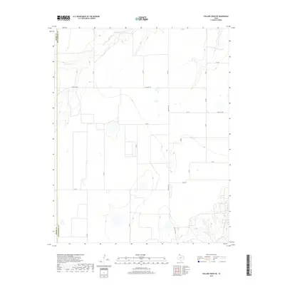
2019 Map of Pollard Creek NE
USGS Topo · Published 2019About this map
S Palo Duro Cr cuts across the northern reaches of the High Plains panhandle, defining a landscape of agricultural parcels and open ranch land along the boundary between Moore Co and Hutchinson Co. This 2019 survey shows the organized grid of the Texas Panhandle, where cattle ranching and farming operations are supported by a systematic network of local roads. The terrain is marked by the drainage of Big Cr in the southeast corner, providing a rare break in the flat topography.
Find a feature on this map
17 named features on this map. Tap any name to fly to it.
Don’t see what you’re looking for? This feature index may not catch every label — zoom into the map to look around manually.
Map Details
Editions of this 2019 Pollard Creek NE Map
This is the sole edition of this map. No revisions or reprints were ever made.
Other maps of this area

1953 · Stinnett
USGS Topo · 1:24,000

1953 · Pringle
USGS Topo · 1:24,000

1954 · Perryton
USGS Topo · 1:250,000

1954 · Amarillo
USGS Topo · 1:250,000

1958 · Perryton
USGS Topo · 1:250,000

1958 · Amarillo
USGS Topo · 1:250,000
1972 · Pollard Creek
USGS Topo · 1:24,000

1972 · Capps Switch
USGS Topo · 1:24,000
1972 · Pollard Creek NW
USGS Topo · 1:24,000

1974 · Morse
USGS Topo · 1:24,000