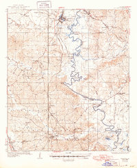
1936 Map of Pollock
USGS Topo · Published 1949About this map
Pollock and the surrounding timberlands of the Kisatchie National Forest anchor this mid-1930s survey of central Louisiana. The landscape is defined by the winding course of Little River, which forms the boundary between Grant and La Salle Parishes. The regional economy is clearly marked by the infrastructure of the Missouri Pacific RR and the Louisiana and Arkansas RR, which serviced industrial sites like the mill at Fishville.
Find a feature on this map
79 named features on this map. Tap any name to fly to it.
Don’t see what you’re looking for? This feature index may not catch every label — zoom into the map to look around manually.
Map Details
Editions of this 1936 Pollock Map
2 editions found
Other maps of this area

1932 · Colfax NE
USGS Topo · 1:31,680

1932 · Boyce NE
USGS Topo · 1:31,680

1932 · Colfax SE
USGS Topo · 1:31,680

1936 · Colfax
USGS Topo · 1:62,500

1936 · Pollock
USGS Topo · 1:62,500

1941 · Jena
USGS Topo · 1:62,500

1941 · Alexandria
USGS Topo · 1:62,500

1941 · Buckeye
USGS Topo · 1:62,500

1941 · Pollock
USGS Topo · 1:62,500

1941 · Boyce
USGS Topo · 1:62,500