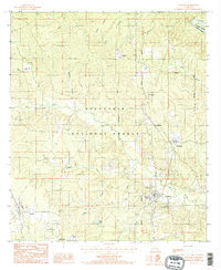
1985 Map of Pollock
USGS Topo · Published 1985About this map
Kisatchie National Forest dominates the central landscape of this Grant Parish survey, where the heavy woods are dissected by a complex network of named drainages like Big Creek and Dyson Creek. The town of Pollock serves as a local hub near the southeastern corner, while Bentley anchors the southwestern edge, both connected by a road network that reflects the region's managed timber and agricultural roots. The presence of the Stuart Pine Seed Orchard and Stuart Lake highlights the intersection of federal conservation and forest management efforts during the mid-1980s. Along the northeastern boundary, the Little River creates a prominent meander known as Big Bend, marking the edge of Grant Parish. Smaller settlements and transit points such as Antonia and Sand Spur are tucked among the forest ridges, alongside industrial markers like the Pumping Station near Jesse Branch.
Find a feature on this map
34 named features on this map. Tap any name to fly to it.
Don’t see what you’re looking for? This feature index may not catch every label — zoom into the map to look around manually.
Map Details
Editions of this 1985 Pollock Map
2 editions found
Other maps of this area

1932 · Colfax NE
USGS Topo · 1:31,680

1932 · Boyce NE
USGS Topo · 1:31,680

1932 · Colfax SE
USGS Topo · 1:31,680

1936 · Colfax
USGS Topo · 1:62,500

1936 · Pollock
USGS Topo · 1:62,500

1941 · Alexandria
USGS Topo · 1:62,500

1941 · Pollock
USGS Topo · 1:62,500

1941 · Boyce
USGS Topo · 1:62,500

1953 · Alexandria
USGS Topo · 1:250,000

1955 · Alexandria
USGS Topo · 1:250,000