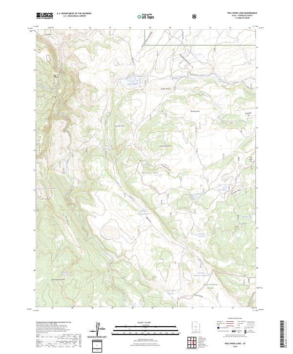
2023 Map of Pollywog Lake
USGS Topo · Published 2023About this map
Pollywog Lake lies at the heart of this high-elevation landscape within the Dixie National Forest, where a complex system of water management and natural drainages defines the terrain. The presence of the Antelope Ditch and several numbered catchments like Big Swale Reservoir Number 1 and Big Swale Reservoir Number 2 highlights the vital role of water engineering in this part of the Escalante Mountains. This 2023 survey illustrates how modern forest management utilizes a network of specialized routes, including the Antimony Knoll Atv Trl and Poison Creek Atv Trl, to navigate between landmarks like Tanner Knoll and the Awapa Plateau. The map provides a detailed look at the geographic features that have long shaped land use in Garfield County, from the steep descent of Death Hollow to the high grazing grounds of Roundup Flat.
Find a feature on this map
45 named features on this map. Tap any name to fly to it.
Don’t see what you’re looking for? This feature index may not catch every label — zoom into the map to look around manually.
Map Details
Editions of this 2023 Pollywog Lake Map
This is the sole edition of this map. No revisions or reprints were ever made.
Other maps of this area

1885 · Fish Lake
USGS Topo · 1:250,000

1886 · Escalante
USGS Topo · 1:250,000

1896 · Fish Lake
USGS Topo · 1:250,000

1956 · Escalante
USGS Topo · 1:250,000

1956 · Salina
USGS Topo · 1:250,000

1960 · Escalante
USGS Topo · 1:250,000

1960 · Salina
USGS Topo · 1:250,000

1962 · Salina
USGS Topo · 1:250,000

1964 · Barker Reservoir
USGS Topo · 1:24,000
1964 · Grass Lakes
USGS Topo · 1:24,000