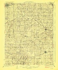
1924 Map of Polo
USGS Topo · Published 1924About this map
Shoal Creek meanders across this Northwest Missouri landscape, anchoring a rural society defined by its township-and-range organization and dense network of neighborhood schools. This 1920s survey captures the region just before the consolidation of rural districts, preserving the locations of dozens of local landmarks like Yankee Ridge School, Lone Star School, and Mound School. The southern portion of the map is dominated by the Chicago Milwaukee and St Paul railroad, which served as a vital commercial artery for settlements such as Polo and Elmira. Historical interest is further deepened by the presence of Far West Church and Deer Creek Union Church, reflecting the area's deep-rooted congregational history. From the early river crossings at Stoner Bridge to the township lines of Mirabile and Kidder, the map documents a transition point between the pioneer era and modern agricultural development.
Find a feature on this map
67 named features on this map. Tap any name to fly to it.
Don’t see what you’re looking for? This feature index may not catch every label — zoom into the map to look around manually.
Map Details
Editions of this 1924 Polo Map
2 editions found
Other maps of this area

1889 · Lexington
USGS Topo · 1:125,000

1894 · Independence
USGS Topo · 1:125,000

1922 · Gallatin
USGS Topo · 1:62,500

1923 · Maysville
USGS Topo · 1:62,500

1924 · Polo
USGS Topo · 1:62,500

1924 · Braymer
USGS Topo · 1:62,500

1924 · Winston
USGS Topo · 1:62,500

1925 · Plattsburg
USGS Topo · 1:62,500

1925 · Maysville
USGS Topo · 1:62,500

1936 · Kearney
USGS Topo · 1:48,000