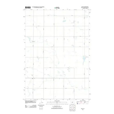
2012 Map of Polo
USGS Topo · Published 2012About this map
Polo anchors this portion of Hand County, situated amidst a grid of section-line roads and a network of seasonal prairie drainages. The landscape is defined by the winding paths of Matter Cr, Schaefer Cr, and N Wolf Cr, which create subtle breaks in the agricultural geometry of the plains. For genealogists and local historians, the presence of Saint Michaels Cem and Calvary Cem provides specific points of interest near the settlement. To the east, the terrain opens into larger wetland features like Costigan Slough and Dienslake Lake, illustrating the typical hydrology of the South Dakota prairie where water collects in shallow depressions. The map details the rural infrastructure of the early 21st century, showing how modern county roads such as 354th Ave and 174th St follow the legacy of the original land surveys.
Find a feature on this map
23 named features on this map. Tap any name to fly to it.
Don’t see what you’re looking for? This feature index may not catch every label — zoom into the map to look around manually.
Map Details
Editions of this 2012 Polo Map
This is the sole edition of this map. No revisions or reprints were ever made.
Other maps of this area

1899 · Redfield
USGS Topo · 1:125,000

1949 · Ree Heights NW
USGS Topo · 1:24,000

1951 · Orient
USGS Topo · 1:24,000

1951 · Ree Heights NW
USGS Topo · 1:24,000

1951 · Orient SW
USGS Topo · 1:24,000

1951 · Polo
USGS Topo · 1:24,000

1951 · Orient NW
USGS Topo · 1:24,000

1951 · Ree Heights NE
USGS Topo · 1:24,000

1953 · Huron
USGS Topo · 1:250,000

1954 · Huron
USGS Topo · 1:250,000