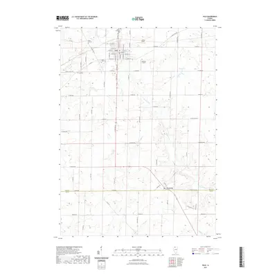
2021 Map of Polo
USGS Topo · Published 2021About this map
The city of Polo serves as the primary hub in this portion of Ogle County, defined by its rectilinear street grid and proximity to the historical Galena Trail Rd. The surrounding landscape is a detailed network of agricultural drainage and small waterways, including Buffalo Cr, Sevenmile Br, and Reid Cr. To the south, the village of Woosung sits right at the boundary of Lee County, connected to the north by S State Rte 26. For those tracing local history, the map identifies several significant burial sites, from the prominent Saint Mary's Cem and Buffalo Grove Cem to the smaller Reed Cem and the specific Durley Gravesite. Aviation history is also represented by the presence of Gentry Airport and Hammer Airport, highlighting the region's mid-century utility infrastructure.
Find a feature on this map
70 named features on this map. Tap any name to fly to it.
Don’t see what you’re looking for? This feature index may not catch every label — zoom into the map to look around manually.
Map Details
Editions of this 2021 Polo Map
This is the sole edition of this map. No revisions or reprints were ever made.
Other maps of this area

1918 · Dixon
USGS Topo · 1:62,500

1922 · Oregon
USGS Topo · 1:62,500

1924 · Oregon
USGS Topo · 1:62,500

1930 · Woodsung
USGS Topo · 1:48,000

1942 · Forreston
USGS Topo · 1:62,500

1945 · Forreston
USGS Topo · 1:62,500

1946 · Sterling
USGS Topo · 1:62,500

1948 · Sterling
USGS Topo · 1:62,500

1950 · Dixon
USGS Topo · 1:62,500

1954 · Rockford
USGS Topo · 1:250,000