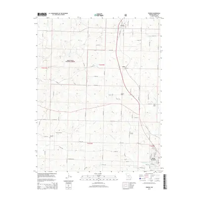
2015 Map of Pomona
USGS Topo · Published 2015About this map
Mark Twain National Forest dominates the western topography of this region, where the Ozark landscape transitions from forested uplands into the agricultural valleys surrounding Pomona and Olden. This 2015 survey illustrates the modern road network of Howell County, centered on the corridor of Highway 63 and its connection to the northern fringes of West Plains. The map provides significant detail for local historians, identifying sites such as Lone Pine Cemetery and New Liberty Cemetery alongside the private Ray's Roost Airport. The drainage patterns are clearly defined, featuring the headwaters of the Middle Fork Eleven Point River and the winding paths of N Fork Howell Cr and Tabor Cr. The map captures a mix of public forest land and private rural acreage, punctuated by established settlements and the natural contours of Gunters Valley.
Find a feature on this map
82 named features on this map. Tap any name to fly to it.
Don’t see what you’re looking for? This feature index may not catch every label — zoom into the map to look around manually.
Map Details
Editions of this 2015 Pomona Map
This is the sole edition of this map. No revisions or reprints were ever made.
Other maps of this area

1938 · West Plains
USGS Topo · 1:24,000

1939 · Topaz
USGS Topo · 1:62,500

1940 · West Plains
USGS Topo · 1:24,000

1941 · Topaz
USGS Topo · 1:62,500

1944 · West Plains
USGS Topo · 1:62,500

1944 · Cureall
USGS Topo · 1:62,500

1945 · Harrison
USGS Topo · 1:250,000

1945 · Willow Springs
USGS Topo · 1:62,500

1946 · West Plains
USGS Topo · 1:62,500

1946 · Cureall
USGS Topo · 1:62,500