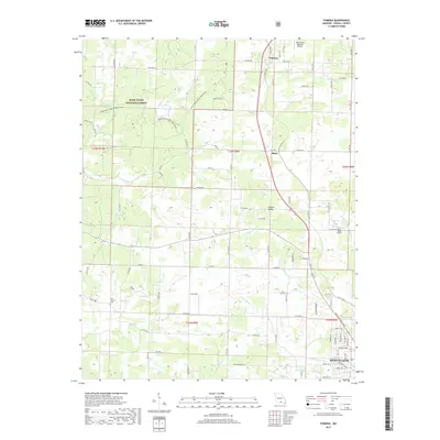
2017 Map of Pomona
USGS Topo · Published 2017About this map
Pomona and Olden anchor the northern reaches of this Howell County terrain, where the Ozark landscape transitions from the protected woodlands of the Mark Twain National Forest into a network of agricultural valleys and creek bottoms. The geography is defined by a dendritic drainage pattern, with Tabor Cr and the N Fork Howell Cr cutting through the central and southern sections. The Ozark Trail-North Fork River winds through the northwestern corner, providing a recreational corridor through the forest. Evidence of local community life is found at the New Liberty Cem and Lone Pine Cem, while the southern edge of the sheet captures the residential expansion of West Plains, showing street layouts like Porter Wagoner Blvd and Deatherage Ave near the city's northern limit.
Find a feature on this map
80 named features on this map. Tap any name to fly to it.
Don’t see what you’re looking for? This feature index may not catch every label — zoom into the map to look around manually.
Map Details
Editions of this 2017 Pomona Map
This is the sole edition of this map. No revisions or reprints were ever made.
Other maps of this area

1938 · West Plains
USGS Topo · 1:24,000

1939 · Topaz
USGS Topo · 1:62,500

1940 · West Plains
USGS Topo · 1:24,000

1941 · Topaz
USGS Topo · 1:62,500

1944 · West Plains
USGS Topo · 1:62,500

1944 · Cureall
USGS Topo · 1:62,500

1945 · Harrison
USGS Topo · 1:250,000

1945 · Willow Springs
USGS Topo · 1:62,500

1946 · West Plains
USGS Topo · 1:62,500

1946 · Cureall
USGS Topo · 1:62,500