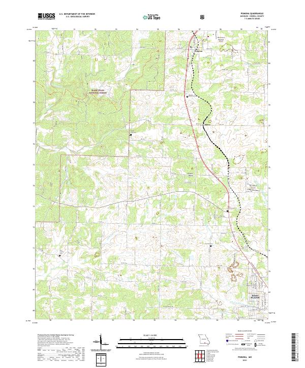
2021 Map of Pomona
USGS Topo · Published 2021About this map
West Plains anchors the southern portion of this Ozark plateau landscape, where the town's northern expansion meets the headwaters of N Fork Howell Cr and Galloway Cr. The geography is defined by a series of north-south drainage patterns, including Spring Cr and Tabor Cr, which cut through the undulating terrain of Gunters Valley. The northern reaches are characterized by the dense canopy of the Mark Twain National Forest, while the central corridor follows a historical transportation spine through the settlements of Olden and Pomona. This area preserves several localized burial sites that offer deep genealogical value, such as Mount Zion Cem and the Sadie Brown Cem. The presence of both the West Plains Regional Airport and Ray's Roost Airport indicates the modern aviation infrastructure layered over a traditionally agricultural and timber-based economy.
Find a feature on this map
85 named features on this map. Tap any name to fly to it.
Don’t see what you’re looking for? This feature index may not catch every label — zoom into the map to look around manually.
Map Details
Editions of this 2021 Pomona Map
This is the sole edition of this map. No revisions or reprints were ever made.
Other maps of this area

1938 · West Plains
USGS Topo · 1:24,000

1939 · Topaz
USGS Topo · 1:62,500

1940 · West Plains
USGS Topo · 1:24,000

1941 · Topaz
USGS Topo · 1:62,500

1944 · West Plains
USGS Topo · 1:62,500

1944 · Cureall
USGS Topo · 1:62,500

1945 · Harrison
USGS Topo · 1:250,000

1945 · Willow Springs
USGS Topo · 1:62,500

1946 · West Plains
USGS Topo · 1:62,500

1946 · Cureall
USGS Topo · 1:62,500