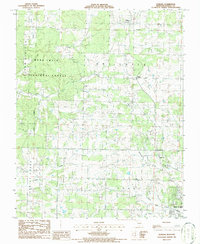
1986 Map of Pomona
USGS Topo · Published 1986About this map
The northern edge of West Plains serves as the focal point for this mid-1980s landscape, where the Missouri Ozarks transition between rural development and the protected timberlands of the Mark Twain National Forest. The map documents a specific period of local growth near the towns of Pomona and Olden, showing a network of community hubs anchored by rural institutions like Mt Zion Ch, New Liberty Ch, and Richards R-5 Sch.
Find a feature on this map
23 named features on this map. Tap any name to fly to it.
Don’t see what you’re looking for? This feature index may not catch every label — zoom into the map to look around manually.
Map Details
Editions of this 1986 Pomona Map
This is the sole edition of this map. No revisions or reprints were ever made.
Other maps of this area

1938 · West Plains
USGS Topo · 1:24,000

1939 · Topaz
USGS Topo · 1:62,500

1940 · West Plains
USGS Topo · 1:24,000

1941 · Topaz
USGS Topo · 1:62,500

1944 · West Plains
USGS Topo · 1:62,500

1944 · Cureall
USGS Topo · 1:62,500

1945 · Harrison
USGS Topo · 1:250,000

1945 · Willow Springs
USGS Topo · 1:62,500

1946 · West Plains
USGS Topo · 1:62,500

1946 · Cureall
USGS Topo · 1:62,500