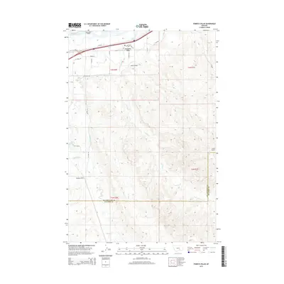
2014 Map of Pompeys Pillar
USGS Topo · Published 2014About this map
Pompeys Pillar sits as the focal point of this northern Montana landscape, located just south of the Yellowstone River and north of the expansive Smith Coulee. This 2014 survey documents the intricate water management systems essential to the region, including the Reservoir Line Canal and Lower Canal Rd, which network across the plains to support local agriculture. The terrain is defined by a series of drainages and coulees, such as Barley Coulee, Lost Cabin Coulee, and Fly Creek, which carve through the high ground. Notable infrastructure includes Us-312 and the Anita Reservoir near Anita Dam Rd. The boundary between Yellowstone Co and Big Horn Co is clearly marked in the southern portion of the map, illustrating how historical political lines intersect with the natural topography of the Yellowstone valley and its surrounding creek systems.
Find a feature on this map
70 named features on this map. Tap any name to fly to it.
Don’t see what you’re looking for? This feature index may not catch every label — zoom into the map to look around manually.
Map Details
Editions of this 2014 Pompeys Pillar Map
This is the sole edition of this map. No revisions or reprints were ever made.
Other maps of this area

1893 · Huntley
USGS Topo · 1:125,000

1894 · Fort Custer
USGS Topo · 1:125,000

1954 · Billings
USGS Topo · 1:250,000

1954 · Hardin
USGS Topo · 1:250,000

1954 · Forsyth
USGS Topo · 1:250,000

1954 · Roundup
USGS Topo · 1:250,000

1957 · Hardin
USGS Topo · 1:250,000

1957 · Forsyth
USGS Topo · 1:250,000

1957 · Billings
USGS Topo · 1:250,000

1958 · Billings
USGS Topo · 1:250,000