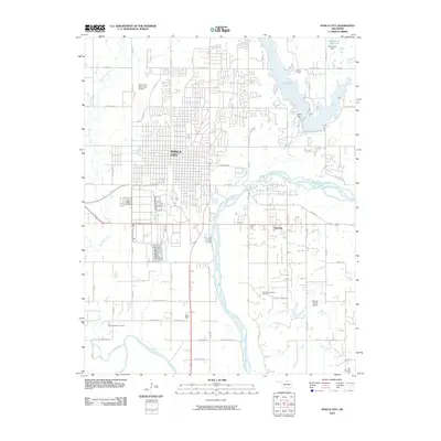
2010 Map of Ponca City
USGS Topo · Published 2010About this map
Ponca City and its surrounding river valleys define this landscape at the start of the twenty-first century. The city's grid extends east toward the sprawling waters of Lake Ponca, which is contained by the Ponca Dam. To the south, the confluence of the Salt Fork Arkansas River and the main channel of the Arkansas River creates a wide, braided floodplain. This area is historically significant as the site of White Eagle and the Ponca Indian Cemetery, reflecting the enduring presence of the Ponca people in their tribal lands. Industrial activity is prominent in the region's economy, evidenced by the Southwest McCord Oil Field and the Big Bend Oil Field to the southeast. Local landmarks such as the Ponca City Municipal Airport and the recreational grounds at Wentz Camp near the Schrickram Reservoir illustrate the diverse land use of this Kay County hub.
Find a feature on this map
45 named features on this map. Tap any name to fly to it.
Don’t see what you’re looking for? This feature index may not catch every label — zoom into the map to look around manually.
Map Details
Editions of this 2010 Ponca City Map
This is the sole edition of this map. No revisions or reprints were ever made.
Other maps of this area

1935 · Kaw
USGS Topo · 1:62,500

1936 · Belford
USGS Topo · 1:62,500

1955 · Enid
USGS Topo · 1:250,000

1958 · Enid
USGS Topo · 1:250,000

1963 · Charley Creek
USGS Topo · 1:24,000

1963 · Uncas
USGS Topo · 1:24,000

1968 · Marland
USGS Topo · 1:24,000

1968 · Ponca City NW
USGS Topo · 1:24,000

1968 · Ponca City SE
USGS Topo · 1:24,000

1968 · Kildare
USGS Topo · 1:24,000