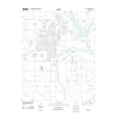
2012 Map of Ponca City
USGS Topo · Published 2012About this map
Arkansas River and Salt-Fork-Arkansas-River converge south of Ponca City, defining a landscape of wide river bottoms and active petroleum extraction. This 2012 survey shows the modern extent of the city, including the Ponca City Regional Airport and the specialized Ponca City Beauty Coll. For genealogists, the map provides precise locations for the Ponca City Independent Order of Odd Fellows Cem and the adjacent Saint Mary's Catholic Cem on the city's western edge. The surrounding countryside is marked by industrial operations such as the Southwest McCord Oil Field and Big Bend Oil Field, reflecting the area's long-standing connection to energy production. Recreational and utility water management is evident at Lake Ponca and the Schrickram Reservoir in the northeast corner of the quadrangle.
Find a feature on this map
92 named features on this map. Tap any name to fly to it.
Don’t see what you’re looking for? This feature index may not catch every label — zoom into the map to look around manually.
Map Details
Editions of this 2012 Ponca City Map
This is the sole edition of this map. No revisions or reprints were ever made.
Other maps of this area

1935 · Kaw
USGS Topo · 1:62,500

1936 · Belford
USGS Topo · 1:62,500

1955 · Enid
USGS Topo · 1:250,000

1958 · Enid
USGS Topo · 1:250,000

1963 · Charley Creek
USGS Topo · 1:24,000

1963 · Uncas
USGS Topo · 1:24,000

1968 · Marland
USGS Topo · 1:24,000

1968 · Ponca City NW
USGS Topo · 1:24,000

1968 · Ponca City SE
USGS Topo · 1:24,000

1968 · Kildare
USGS Topo · 1:24,000