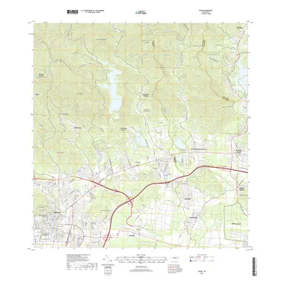
2018 Map of Ponce
USGS Topo · Published 2018About this map
Ponce sits at the base of the island's southern slopes, where the Rio Cerrillos and Rio Jacaguas feed the coastal plain. This 2018 survey documents a modern landscape shaped by major infrastructure, most notably the sprawling Mercedita Airport and the complex interchanges of the Autopista Luis A Ferre. Amidst this development, the map preserves landmarks of significant local heritage, including the Panteon Nacional Roman Baldorioty de Castro and the historic Puente de los Leones. The transition from the urban density of the city center to the surrounding hills is marked by numerous residential communities and settlements such as Luis Llorens Torres, Aguilita, and Cerrillos Hoyos. To the east, the presence of Fort Allen and the residential clusters of Capitanejo and Calzada define the edge of the municipality, illustrating the continued importance of military and suburban footprints in the region.
Find a feature on this map
47 named features on this map. Tap any name to fly to it.
Don’t see what you’re looking for? This feature index may not catch every label — zoom into the map to look around manually.
Map Details
Editions of this 2018 Ponce Map
This is the sole edition of this map. No revisions or reprints were ever made.
Other maps of this area

1944 · Santa Isabel
USGS Topo · 1:30,000

1945 · Playa De Ponce
USGS Topo · 1:30,000

1945 · Ponce
USGS Topo · 1:30,000

1945 · Rio Descalabrado
USGS Topo · 1:30,000

1946 · Punta Cuchara
USGS Topo · 1:30,000

1946 · Jayuya
USGS Topo · 1:30,000

1946 · Orocovis
USGS Topo · 1:30,000

1946 · Penuelas
USGS Topo · 1:30,000

1946 · Adjuntas
USGS Topo · 1:30,000

1947 · Ponce NE
USGS Topo · 1:10,000