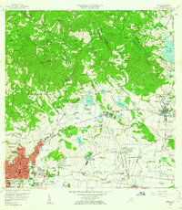
1958 Map of Ponce
USGS Topo · Published 1961About this map
Ponce and the surrounding agricultural valleys are depicted during a period of transition in the late 1950s. The urban core of the city is divided into traditional sectors like Primero, Segundo, and Tercero, while the northern hills are dotted with established estates including Hacienda Arbona and Hacienda Paraiso. This survey illustrates the landscape before the heavy industrialization of later decades, showing the significant footprint of the Fort Allen Military Reservation to the southeast and the developing Aeropuerto on the southern coastal plain.
Find a feature on this map
181 named features on this map. Tap any name to fly to it.
Don’t see what you’re looking for? This feature index may not catch every label — zoom into the map to look around manually.
Map Details
Editions of this 1958 Ponce Map
This is the sole edition of this map. No revisions or reprints were ever made.
Other maps of this area

1944 · Santa Isabel
USGS Topo · 1:30,000

1945 · Playa De Ponce
USGS Topo · 1:30,000

1945 · Ponce
USGS Topo · 1:30,000

1945 · Rio Descalabrado
USGS Topo · 1:30,000

1946 · Punta Cuchara
USGS Topo · 1:30,000

1946 · Jayuya
USGS Topo · 1:30,000

1946 · Orocovis
USGS Topo · 1:30,000

1946 · Penuelas
USGS Topo · 1:30,000

1946 · Adjuntas
USGS Topo · 1:30,000

1947 · Ponce NE
USGS Topo · 1:10,000