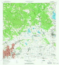
1964 Map of Ponce
USGS Topo · Published 1965About this map
The agricultural and urban landscape of southern Puerto Rico is captured here during a period of industrial expansion, centered on the historic Central Mercedita sugar mill. This industrial hub, located near the Aeropuerto Mercedita, stands as a centerpiece for the surrounding barrios of Sabanetas and Vayas. To the west, the city of Ponce displays its established street grid, featuring the Parque de Bombas and Plaza Degetau, alongside educational institutions like the Universidad Católica and Liceo Ponceño.
Find a feature on this map
191 named features on this map. Tap any name to fly to it.
Don’t see what you’re looking for? This feature index may not catch every label — zoom into the map to look around manually.
Map Details
Editions of this 1964 Ponce Map
This is the sole edition of this map. No revisions or reprints were ever made.
Other maps of this area

1944 · Santa Isabel
USGS Topo · 1:30,000

1945 · Playa De Ponce
USGS Topo · 1:30,000

1945 · Ponce
USGS Topo · 1:30,000

1945 · Rio Descalabrado
USGS Topo · 1:30,000

1946 · Punta Cuchara
USGS Topo · 1:30,000

1946 · Jayuya
USGS Topo · 1:30,000

1946 · Orocovis
USGS Topo · 1:30,000

1946 · Penuelas
USGS Topo · 1:30,000

1946 · Adjuntas
USGS Topo · 1:30,000

1947 · Ponce NE
USGS Topo · 1:10,000