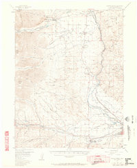
1956 Map of Poncha Springs
USGS Topo · Published 1962About this map
Arkansas River water rights and mountain topography define this mid-century survey of the Chaffee County corridor. The valley floor is marked by the infrastructure of early settlement and industry, notably the Denver and Rio Grande Western Railroad winding through Browns Canon toward Salida. Local civic life is concentrated in small nodes like Centerville, which includes the Centerville Ch, Centerville Sch, and a nearby Centerville Cem, reflecting the clustered nature of agricultural and ranching communities in the shadow of the San Isabel National Forest.
Find a feature on this map
88 named features on this map. Tap any name to fly to it.
Don’t see what you’re looking for? This feature index may not catch every label — zoom into the map to look around manually.
Map Details
Editions of this 1956 Poncha Springs Map
6 editions found

Other maps of this area

1940 · Garfield
USGS Topo · 1:62,500

1945 · Garfield
USGS Topo · 1:62,500

1954 · Pueblo
USGS Topo · 1:250,000

1955 · Buena Vista
USGS Topo · 1:62,500

1955 · Mount Harvard
USGS Topo · 1:62,500

1956 · Cameron Mountain
USGS Topo · 1:62,500

1956 · Poncha Springs
USGS Topo · 1:62,500

1956 · Montrose
USGS Topo · 1:250,000

1957 · Pueblo
USGS Topo · 1:250,000

1958 · Pueblo
USGS Topo · 1:250,000