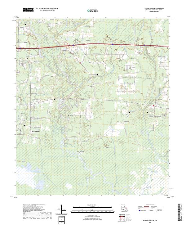
2024 Map of Ponchatoula NE
USGS Topo · Published 2024About this map
Lees Landing sits at the heart of this landscape, where the Tangipahoa River begins its winding descent through the lowland marshes of southern Tangipahoa Parish. The map reveals a transition from the structured township divisions of the north to the expansive Four Mile Marsh and Black Bayou systems in the south. This area is characterized by a dense network of water bodies, including P-Kaw-Shun Creek, Mile Branch, and Bedico Creek, which have historically dictated the patterns of settlement and transport.
Find a feature on this map
126 named features on this map. Tap any name to fly to it.
Don’t see what you’re looking for? This feature index may not catch every label — zoom into the map to look around manually.
Map Details
Editions of this 2024 Ponchatoula NE Map
This is the sole edition of this map. No revisions or reprints were ever made.
Other maps of this area

1935 · Covington
USGS Topo · 1:62,500

1935 · Ponchatoula
USGS Topo · 1:62,500

1939 · Ponchatoula
USGS Topo · 1:62,500

1939 · Covington
USGS Topo · 1:62,500

1940 · Tickfaw
USGS Topo · 1:31,680

1942 · Onville
USGS Topo · 1:31,680

1942 · Robert
USGS Topo · 1:31,680

1950 · Covington
USGS Topo · 1:62,500

1951 · Ponchatoula
USGS Topo · 1:62,500

1954 · Folsom
USGS Topo · 1:62,500