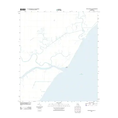
2012 Map of Ponchatoula SE
USGS Topo · Published 2012About this map
Lake Pontchartrain dominates the southeastern portion of this coastal Louisiana landscape, where a complex network of waterways defines the geography of Tangipahoa Parish. The central navigational artery, Pass Manchac, serves as the primary connection between the open lake and interior basins, marked by the historic Pass Manchac Lighthouse standing watch near the shoreline. The drainage pattern is characterized by numerous slow-moving channels, including North Pass and the meandering Tangipahoa River, which carries upland waters toward the coast.
Find a feature on this map
10 named features on this map. Tap any name to fly to it.
Don’t see what you’re looking for? This feature index may not catch every label — zoom into the map to look around manually.
Map Details
Editions of this 2012 Ponchatoula SE Map
This is the sole edition of this map. No revisions or reprints were ever made.
Other maps of this area

1891 · Spanish Fort
USGS Topo · 1:62,500

1892 · Bonnet Carre
USGS Topo · 1:62,500

1935 · Covington
USGS Topo · 1:62,500

1935 · Ponchatoula
USGS Topo · 1:62,500

1936 · Ruddock
USGS Topo · 1:31,680

1936 · Bonnet Carre
USGS Topo · 1:62,500

1936 · Spanish Fort
USGS Topo · 1:62,500

1939 · Ponchatoula
USGS Topo · 1:62,500

1939 · Covington
USGS Topo · 1:62,500

1950 · Covington
USGS Topo · 1:62,500