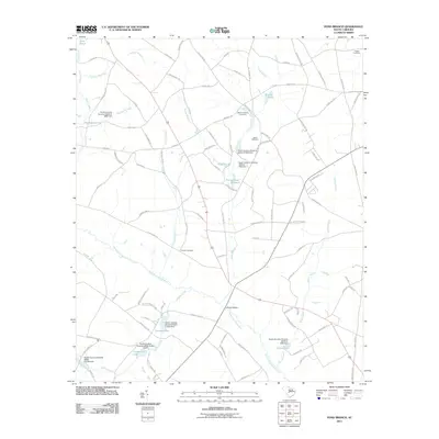
2011 Map of Pond Branch
USGS Topo · Published 2011About this map
The North Fork Edisto River carves through this South Carolina landscape, defining a region where water management and family history are deeply intertwined. Numerous small impoundments and dams, such as Corbett Lake and Caughman Lake, dot the drainage basins of Hollow Creek and Salem Creek, reflecting the local agricultural and land-use patterns of the early 21st century. The map is particularly valuable for genealogical research, documenting several established family burial grounds including Hooker Cemetery, Leaird Cemetery, and the Jeffcoat-Chaney Cemetery. A network of local routes like Swansea Rd and Forts Pond Rd connect these rural points, while landmarks such as Jeffcoat Bridge and Pooles Upper Millpond indicate long-standing community centers and historical industrial sites along the moving water.
Find a feature on this map
103 named features on this map. Tap any name to fly to it.
Don’t see what you’re looking for? This feature index may not catch every label — zoom into the map to look around manually.
Map Details
Editions of this 2011 Pond Branch Map
This is the sole edition of this map. No revisions or reprints were ever made.
Other maps of this area

1944 · Gilbert
USGS Topo · 1:62,500

1944 · Seivern
USGS Topo · 1:62,500

1944 · Edmund
USGS Topo · 1:62,500

1946 · Woodford
USGS Topo · 1:62,500

1954 · Augusta
USGS Topo · 1:250,000

1957 · Augusta
USGS Topo · 1:250,000

1958 · Augusta
USGS Topo · 1:250,000

1961 · Augusta
USGS Topo · 1:250,000

1962 · Augusta
USGS Topo · 1:250,000
1972 · Pelion East
USGS Topo · 1:24,000