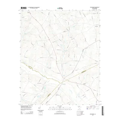
2014 Map of Pond Branch
USGS Topo · Published 2014About this map
The N Fork Edisto River carves a winding path across this Lexington County landscape, serving as a natural boundary between Aiken and Orangeburg counties. A series of historic water-management features define the local hydrology, including Pooles Upper Millpond, Jeffcoats Millpond, and Pooles Millpond, all situated along the course of Pond Br. These millponds suggest a legacy of local industry that once relied on the steady flow of the river's tributaries.
Find a feature on this map
93 named features on this map. Tap any name to fly to it.
Don’t see what you’re looking for? This feature index may not catch every label — zoom into the map to look around manually.
Map Details
Editions of this 2014 Pond Branch Map
This is the sole edition of this map. No revisions or reprints were ever made.
Other maps of this area

1944 · Gilbert
USGS Topo · 1:62,500

1944 · Seivern
USGS Topo · 1:62,500

1944 · Edmund
USGS Topo · 1:62,500

1946 · Woodford
USGS Topo · 1:62,500

1954 · Augusta
USGS Topo · 1:250,000

1957 · Augusta
USGS Topo · 1:250,000

1958 · Augusta
USGS Topo · 1:250,000

1961 · Augusta
USGS Topo · 1:250,000

1962 · Augusta
USGS Topo · 1:250,000
1972 · Pelion East
USGS Topo · 1:24,000