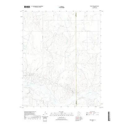
2019 Map of Pond Creek
USGS Topo · Published 2019About this map
The N Fork Red River snakes across the southern portion of this landscape, carving a wide bed through the Panhandle terrain on the border of Gray and Wheeler counties. The hydrology of this region is characterized by seasonal drainages and scattered watering holes, including the isolated White Horse Spring and several small basins such as Tadpole Lake and Haynes Lake. A network of ranch roads and county lines, such as CO Line Rd and Ranch Rd 2857, provides access to the vast grazing lands typical of this part of Texas. Notable topographical landmarks like Devils Gulch and Stage Hollow offer a glimpse into the natural erosion patterns that define the local breaks. The convergence of Cantonment Cr and Pond Cr with the river highlights the drainage network that sustains the area's agricultural and ranching lifestyle.
Find a feature on this map
29 named features on this map. Tap any name to fly to it.
Don’t see what you’re looking for? This feature index may not catch every label — zoom into the map to look around manually.
Map Details
Editions of this 2019 Pond Creek Map
This is the sole edition of this map. No revisions or reprints were ever made.
Other maps of this area

1954 · Amarillo
USGS Topo · 1:250,000

1958 · Amarillo
USGS Topo · 1:250,000

1962 · Hudgens Ranch
USGS Topo · 1:24,000

1962 · Back
USGS Topo · 1:24,000

1962 · Pond Creek
USGS Topo · 1:24,000

1962 · Spring Creek
USGS Topo · 1:24,000

1962 · Pakan
USGS Topo · 1:24,000

1962 · Pond Creek NW
USGS Topo · 1:24,000

1963 · Mobeetie
USGS Topo · 1:24,000

1966 · Laketon
USGS Topo · 1:24,000