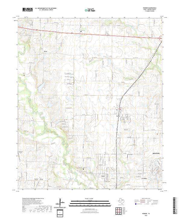
2022 Map of Ponder
USGS Topo · Published 2022About this map
Denton Creek and its many tributaries, including Wolf Br and Hog Br, carve a winding path through this portion of North Texas. The settlement of Ponder serves as a central hub, flanked by the unique municipal boundaries of Dish and the expanding residential reaches of Northlake. The map reveals a landscape defined by its aviation history and rural roots, featuring several small airfields like Hicks Airport, Clark Airport, and the aptly named Dew Drop Airport near the community of Drop. Local history is preserved in several burial grounds, including the Stony Cem near the settlement of Stony and the Muslim Cem to the north. A dense network of farm-to-market roads, such as FM 156 and FM 2449, connects these dispersed communities across the prairie.
Find a feature on this map
106 named features on this map. Tap any name to fly to it.
Don’t see what you’re looking for? This feature index may not catch every label — zoom into the map to look around manually.
Map Details
Editions of this 2022 Ponder Map
This is the sole edition of this map. No revisions or reprints were ever made.
Other maps of this area

1954 · Sherman
USGS Topo · 1:250,000

1958 · Sherman
USGS Topo · 1:250,000

1959 · Ponder
USGS Topo · 1:24,000
1960 · Justin
USGS Topo · 1:24,000

1960 · Sanger
USGS Topo · 1:24,000

1960 · Bluett
USGS Topo · 1:24,000
1960 · Argyle
USGS Topo · 1:24,000

1960 · Rhome
USGS Topo · 1:24,000
1960 · Denton West
USGS Topo · 1:24,000

1961 · Slidell
USGS Topo · 1:24,000