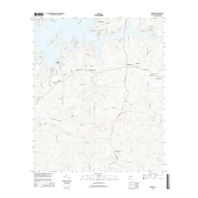
2014 Map of Ponders
USGS Topo · Published 2014About this map
Martin Lake dominates the northern reaches of this Tallapoosa County landscape, where the irregular shoreline of the reservoir creates numerous inlets and peninsulas. The area around Still Waters and Bama Park shows a modern transition toward lakeside residential development, with winding roads like Silver Hills Rd and Natchez Rd tracing the fingers of land. This modern layout contrasts sharply with the older rural settlement patterns found further south toward Barnesville and Walnut Hill.
Find a feature on this map
89 named features on this map. Tap any name to fly to it.
Don’t see what you’re looking for? This feature index may not catch every label — zoom into the map to look around manually.
Map Details
Editions of this 2014 Ponders Map
This is the sole edition of this map. No revisions or reprints were ever made.
Other maps of this area

1906 · Dadeville
USGS Topo · 1:125,000

1955 · Phenix City
USGS Topo · 1:250,000

1957 · Phenix City
USGS Topo · 1:250,000

1958 · Phenix City
USGS Topo · 1:250,000
1971 · Dadeville
USGS Topo · 1:24,000

1971 · Ponders
USGS Topo · 1:24,000

1971 · Carrville
USGS Topo · 1:24,000
1971 · Tallassee
USGS Topo · 1:24,000
1971 · Camp Hill
USGS Topo · 1:24,000

1971 · Thornton
USGS Topo · 1:24,000