
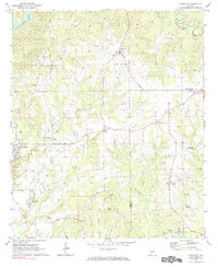
1971 Map of Carrville
USGS Topo · Published 1973About this map
Carrville and Tallassee anchor the southwestern corner of this survey, which captures a landscape of small agricultural communities and rural schoolhouses across Tallapoosa and Macon counties in the early 1970s. The terrain is deeply etched by a network of waterways including Sougahatchee Creek and Stone Creek, where numerous gravel pits indicate local extractive industry. Small centers like Reeltown, with its Reeltown High Sch, and Liberty City are connected by a web of light-duty roads, while the presence of The Barroom and Golddust marks distinct local named places in the hills. Genealogists will find value in the specific locations of Sharon Ch, Sharon Cem, and Elam Ch. Significant landmarks like the Broach Mill on Bulger Creek and the Drive-in Theater near the western boundary reflect the era's social and economic infrastructure just as modernization began to alter the older rural patterns.
Find a feature on this map
32 named features on this map. Tap any name to fly to it.
Don’t see what you’re looking for? This feature index may not catch every label — zoom into the map to look around manually.
Map Details
Editions of this 1971 Carrville Map
2 editions found
Other maps of this area

1906 · Dadeville
USGS Topo · 1:125,000

1955 · Phenix City
USGS Topo · 1:250,000

1957 · Phenix City
USGS Topo · 1:250,000

1958 · Phenix City
USGS Topo · 1:250,000

1971 · Ponders
USGS Topo · 1:24,000
1971 · Tallassee
USGS Topo · 1:24,000

1971 · Tuskegee
USGS Topo · 1:24,000

1971 · Shorter
USGS Topo · 1:24,000

1971 · Thornton
USGS Topo · 1:24,000
1971 · Notasulga
USGS Topo · 1:24,000