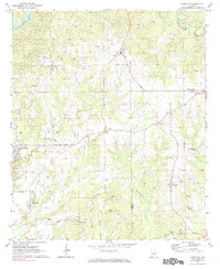
1971 Map of Carrville
USGS Topo · Published 1984About this map
Sougahatchee Creek and Coon Creek define the drainage patterns of this rural stretch of Alabama along the border of Tallapoosa and Macon counties. At the time of this 1971 field check, the landscape is dotted with small community centers like Reeltown, which features a High Sch and Water Tank, and Carrville just north of Tallassee. The area shows a transition from agricultural use to light industrial and recreational markers, including several Gravel Pit operations and a Drive-in Theater near the western edge.
Find a feature on this map
30 named features on this map. Tap any name to fly to it.
Don’t see what you’re looking for? This feature index may not catch every label — zoom into the map to look around manually.
Map Details
Editions of this 1971 Carrville Map
2 editions found
Other maps of this area

1906 · Dadeville
USGS Topo · 1:125,000

1955 · Phenix City
USGS Topo · 1:250,000

1957 · Phenix City
USGS Topo · 1:250,000

1958 · Phenix City
USGS Topo · 1:250,000

1971 · Ponders
USGS Topo · 1:24,000

1971 · Carrville
USGS Topo · 1:24,000
1971 · Tallassee
USGS Topo · 1:24,000

1971 · Tuskegee
USGS Topo · 1:24,000

1971 · Shorter
USGS Topo · 1:24,000

1971 · Thornton
USGS Topo · 1:24,000