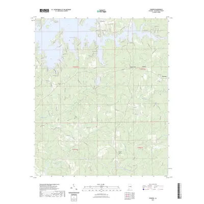
2023 Map of Ponders
USGS Topo · Published 2023About this map
Martin Lake dominates the northern reaches of this Tallapoosa County landscape, where winding inlets and residential developments like Walnut Hill and Ponders meet the water's edge. The terrain transitioning away from the lake is defined by a series of south-flowing drainages, including Wind Creek and Sougahatchee Creek, which carve through the wooded hills. This modern survey illustrates the juxtaposition of contemporary lakeside recreation with deep-rooted rural history, evidenced by numerous family and community burial sites scattered across the township lines.
Find a feature on this map
98 named features on this map. Tap any name to fly to it.
Don’t see what you’re looking for? This feature index may not catch every label — zoom into the map to look around manually.
Map Details
Editions of this 2023 Ponders Map
This is the sole edition of this map. No revisions or reprints were ever made.
Other maps of this area

1906 · Dadeville
USGS Topo · 1:125,000

1955 · Phenix City
USGS Topo · 1:250,000

1957 · Phenix City
USGS Topo · 1:250,000

1958 · Phenix City
USGS Topo · 1:250,000
1971 · Dadeville
USGS Topo · 1:24,000

1971 · Ponders
USGS Topo · 1:24,000

1971 · Carrville
USGS Topo · 1:24,000
1971 · Tallassee
USGS Topo · 1:24,000
1971 · Camp Hill
USGS Topo · 1:24,000

1971 · Thornton
USGS Topo · 1:24,000