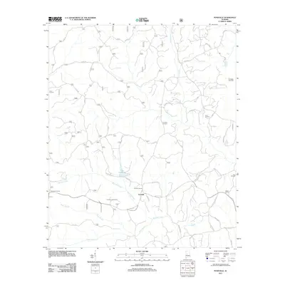
2011 Map of Pondville
USGS Topo · Published 2011About this map
Pondville serves as the central hub of this Bibb County landscape, situated along a network of rural routes and creek drainages. The area is defined by its significant concentration of local burial grounds, including the Union Cemetery, Friendship Cemetery, and the Mulberry Cemeteries, which provide valuable location data for genealogical research. Natural water features like Blue Girth Creek and Yeager Branch carve through the terrain, while the Pondville Lookout Tower stands as a prominent man-made landmark near the center of the survey. The road network, including the Pondville Cutoff and W Eoline Road, connects scattered residences and family-named landmarks like Lake Ponderosa and the Kornegay Lake Dam. This mapping captures the rural character of the region, where topographical features such as Ragland Gully and numerous small branches dictate the placement of local homesteads and historical cemeteries.
Find a feature on this map
45 named features on this map. Tap any name to fly to it.
Don’t see what you’re looking for? This feature index may not catch every label — zoom into the map to look around manually.
Map Details
Editions of this 2011 Pondville Map
This is the sole edition of this map. No revisions or reprints were ever made.
Other maps of this area

1899 · Brookwood
USGS Topo · 1:125,000

1931 · Cottondale
USGS Topo · 1:48,000

1934 · Cottondale
USGS Topo · 1:62,500

1934 · Blocton
USGS Topo · 1:48,000

1940 · Blocton
USGS Topo · 1:62,500

1953 · Montgomery
USGS Topo · 1:250,000

1953 · Birmingham
USGS Topo · 1:250,000

1956 · Birmingham
USGS Topo · 1:250,000

1956 · Montgomery
USGS Topo · 1:250,000

1957 · Birmingham
USGS Topo · 1:250,000