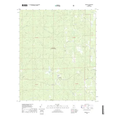
2018 Map of Pondville
USGS Topo · Published 2018About this map
The settlement of Pondville serves as a central hub in this portion of Bibb County, situated at the edge of the Talladega National Forest. The landscape is defined by a dense network of watercourses and topographical features, such as the distinctive Ragland Gully and the waters of Lake Ponderosa. For those tracing local families, numerous burial grounds are documented throughout the area, including Friendship Cem, Pondville Cem, and Mulberry Cem. This contemporary survey reveals a rural infrastructure where traditional local names persist, seen in roads like Elam School House Rd and Ward School Rd. The drainage pattern is well-defined by several tributaries, notably Blue-Girth Cr, Miller Br, and Yeager Br, which carve through the forested terrain and connect the various townships and ranges.
Find a feature on this map
49 named features on this map. Tap any name to fly to it.
Don’t see what you’re looking for? This feature index may not catch every label — zoom into the map to look around manually.
Map Details
Editions of this 2018 Pondville Map
This is the sole edition of this map. No revisions or reprints were ever made.
Other maps of this area

1899 · Brookwood
USGS Topo · 1:125,000

1931 · Cottondale
USGS Topo · 1:48,000

1934 · Cottondale
USGS Topo · 1:62,500

1934 · Blocton
USGS Topo · 1:48,000

1940 · Blocton
USGS Topo · 1:62,500

1953 · Montgomery
USGS Topo · 1:250,000

1953 · Birmingham
USGS Topo · 1:250,000

1956 · Birmingham
USGS Topo · 1:250,000

1956 · Montgomery
USGS Topo · 1:250,000

1957 · Birmingham
USGS Topo · 1:250,000