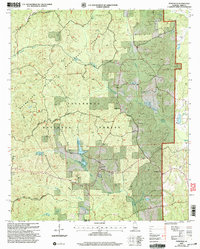
2002 Map of Pondville
USGS Topo · Published 2003About this map
The Talladega National Forest encompasses the majority of this landscape in Bibb County, creating a mosaic of public land that borders the Bibb Co Perry Co line. Centered on the settlement of Pondville, the area is defined by a dense network of watercourses including Blue Girth Creek and Affonee Creek. The map documents a significant intersection of conservation and community, as the Oakmulgee Wildlife Management Area overlaps with long-established rural landmarks.
Find a feature on this map
22 named features on this map. Tap any name to fly to it.
Don’t see what you’re looking for? This feature index may not catch every label — zoom into the map to look around manually.
Map Details
Editions of this 2002 Pondville Map
This is the sole edition of this map. No revisions or reprints were ever made.
Other maps of this area

1899 · Brookwood
USGS Topo · 1:125,000

1931 · Cottondale
USGS Topo · 1:48,000

1934 · Cottondale
USGS Topo · 1:62,500

1934 · Blocton
USGS Topo · 1:48,000

1940 · Blocton
USGS Topo · 1:62,500

1953 · Montgomery
USGS Topo · 1:250,000

1953 · Birmingham
USGS Topo · 1:250,000

1956 · Birmingham
USGS Topo · 1:250,000

1956 · Montgomery
USGS Topo · 1:250,000

1957 · Birmingham
USGS Topo · 1:250,000