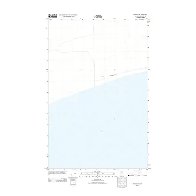
2013 Map of Ponemah NE
USGS Topo · Published 2013About this map
Upper Red Lake dominates the southern half of this landscape, its vast northern shoreline marking the boundary between open water and the low-lying wetlands of Beltrami County. The terrain is defined by its drainage patterns, notably where the Deer River flows toward the lake and is intersected by the engineered channel of Ditch Number Thirty. Human presence is sparse in this 2013 survey, primarily indicated by the primitive path of Blanchard Forest Rd which parallels the lake shore. This region represents the characteristically flat, water-saturated geography of northern Minnesota, where natural river systems and early 20th-century drainage projects coexist. The map provides a precise look at the modern shoreline and the network of forest roads used to navigate the remote bog and peatland north of the water.
Find a feature on this map
4 named features on this map. Tap any name to fly to it.
Don’t see what you’re looking for? This feature index may not catch every label — zoom into the map to look around manually.
Map Details
Editions of this 2013 Ponemah NE Map
This is the sole edition of this map. No revisions or reprints were ever made.
Other maps of this area

1919 · G
USGS Topo · 1:62,500

1919 · Fox
USGS Topo · 1:62,500

1919 · Ponemah
USGS Topo · 1:62,500

1919 · Knutson
USGS Topo · 1:62,500

1943 · Ponemah
USGS Topo · 1:62,500

1954 · Roseau
USGS Topo · 1:250,000

1957 · Roseau
USGS Topo · 1:250,000

1958 · Roseau
USGS Topo · 1:250,000
1973 · Waskish NW
USGS Topo · 1:24,000
1973 · Chase Brook SW
USGS Topo · 1:24,000