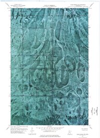
1973 Map of Chase Brook SW
USGS Topo · Published 1976About this map
Red Lake Indian Reservation lands dominate this orthophotomap, showing a landscape defined by expansive wetlands and timber stands within the Beltrami Island State Forest. The imagery reveals a series of distinct, elongated north-south trending ridges and islands of vegetation, characteristic of this peatland region. This area, shared between Beltrami Co and Lake of the Woods Co, serves as the Red Lake State Wildlife Management Area. Human impact is visible primarily through seasonal transport routes like the Winter Trail and drainage patterns near Troy Cr. The map lacks the typical grid of roads found in more settled regions, highlighting the remote and protected nature of the reservation and state forest lands during the early 1970s.
Find a feature on this map
7 named features on this map. Tap any name to fly to it.
Don’t see what you’re looking for? This feature index may not catch every label — zoom into the map to look around manually.
Map Details
Editions of this 1973 Chase Brook SW Map
This is the sole edition of this map. No revisions or reprints were ever made.
Other maps of this area

1919 · G
USGS Topo · 1:62,500

1919 · Fox
USGS Topo · 1:62,500

1919 · Ponemah
USGS Topo · 1:62,500

1919 · Knutson
USGS Topo · 1:62,500

1943 · Ponemah
USGS Topo · 1:62,500

1954 · Roseau
USGS Topo · 1:250,000

1957 · Roseau
USGS Topo · 1:250,000

1958 · Roseau
USGS Topo · 1:250,000
1973 · Ludlow Lookout Tower
USGS Topo · 1:24,000
1973 · Waskish NW
USGS Topo · 1:24,000