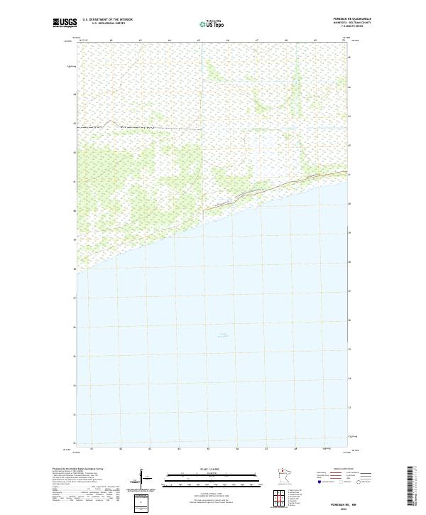
2022 Map of Ponemah NE
USGS Topo · Published 2022About this map
Upper Red Lake dominates the southern half of this landscape in northern Minnesota, where the shoreline marks a sharp transition from open water to the extensive wetlands of Beltrami County. The northern section is defined by a dense network of water management and transport routes, including the prominent channel of Ditch Number Thirty and the meandering course of the Deer River. This terrain is accessed primarily by the Consolidated Conservation Trails Trl and Blanchard Trl NE, which skirt the northern edge of the lake. These features reflect the mid-twentieth-century efforts to manage the peatlands and forests of the Red Lake Indian Reservation for conservation and forestry, creating a distinctive pattern of straight-line drainage cuts juxtaposed with natural riparian systems.
Find a feature on this map
9 named features on this map. Tap any name to fly to it.
Don’t see what you’re looking for? This feature index may not catch every label — zoom into the map to look around manually.
Map Details
Editions of this 2022 Ponemah NE Map
This is the sole edition of this map. No revisions or reprints were ever made.
Other maps of this area

1919 · G
USGS Topo · 1:62,500

1919 · Fox
USGS Topo · 1:62,500

1919 · Ponemah
USGS Topo · 1:62,500

1919 · Knutson
USGS Topo · 1:62,500

1943 · Ponemah
USGS Topo · 1:62,500

1954 · Roseau
USGS Topo · 1:250,000

1957 · Roseau
USGS Topo · 1:250,000

1958 · Roseau
USGS Topo · 1:250,000
1973 · Waskish NW
USGS Topo · 1:24,000
1973 · Chase Brook SW
USGS Topo · 1:24,000