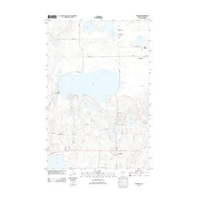
2013 Map of Ponsford
USGS Topo · Published 2013About this map
Pine Point and Ponsford anchor the northern reaches of this Becker County landscape, where the Shell River system connects a dense network of glacial lakes. The map reveals a cultural history preserved through numerous local burying grounds, including the Grand Medicine Cem and Saint Theodores Cem near Aspinwall Lake, and the Breck Memorial Cem further east. These sites, alongside the Emmanuel Lutheran Cem to the southwest, suggest a legacy of distinct communities sharing this lake-rich territory.
Find a feature on this map
46 named features on this map. Tap any name to fly to it.
Don’t see what you’re looking for? This feature index may not catch every label — zoom into the map to look around manually.
Map Details
Editions of this 2013 Ponsford Map
This is the sole edition of this map. No revisions or reprints were ever made.
Other maps of this area

1953 · Brainerd
USGS Topo · 1:250,000

1954 · Bemidji
USGS Topo · 1:250,000

1957 · Brainerd
USGS Topo · 1:250,000

1957 · Bemidji
USGS Topo · 1:250,000

1958 · Bemidji
USGS Topo · 1:250,000

1958 · Brainerd
USGS Topo · 1:250,000

1959 · Toad Mountain
USGS Topo · 1:24,000

1959 · Height Of Land Lake
USGS Topo · 1:24,000

1965 · Brainerd
USGS Topo · 1:250,000

1969 · Many Point Lake
USGS Topo · 1:24,000