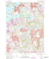
1968 Map of Pontiac South
USGS Topo · Published 1984About this map
Glacial lakes and suburban development define this Oakland County landscape during a period of rapid mid-century growth. The terrain is dominated by water bodies like Cass Lake, Pine Lake, and Walnut Lake, which shaped the residential character of communities such as Orchard Lake Village and Keego Harbor. The presence of institutional landmarks like St Marys College and Midwestern Baptist College alongside recreation hubs such as Dodge Brothers State Park No 4 highlights the area's dual role as a quiet lake retreat and an emerging educational center.
Find a feature on this map
112 named features on this map. Tap any name to fly to it.
Don’t see what you’re looking for? This feature index may not catch every label — zoom into the map to look around manually.
Map Details
Editions of this 1968 Pontiac South Map
3 editions found
Other maps of this area

1905 · Wayne
USGS Topo · 1:62,500

1905 · Detroit
USGS Topo · 1:62,500

1907 · Pontiac
USGS Topo · 1:62,500

1908 · Rochester
USGS Topo · 1:62,500

1912 · Wayne
USGS Topo · 1:62,500

1918 · Detroit
USGS Topo · 1:62,500

1924 · Detroit
USGS Topo · 1:62,500

1934 · Detroit
USGS Topo · 1:62,500

1936 · Birmingham
USGS Topo · 1:31,680

1936 · Clarkston
USGS Topo · 1:31,680