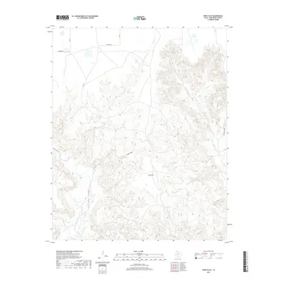
2019 Map of Pony Flats
USGS Topo · Published 2019About this map
Pony Flats sits atop the high plains of Armstrong County, overlooking the intricate drainage systems that feed into the Prairie Dog Town Fork Red River. The landscape is defined by the sharp transition from flat tabletop land into the deep, eroded breaks of Palo Duro Canyon. Numerous seasonal waterways such as Rush Cr, McFarland Cr, and Antibust Cr carve into the terrain, creating complex geological formations like Bull Canyon and Horseshoe Canyon. This geography influenced the development of local transit, seen in the isolated path of November Rd and the Equestrian Trail. The presence of Pony Spring and its associated Pony Spring Cr highlights the critical role of reliable water sources in this semi-arid section of the Texas Panhandle.
Find a feature on this map
16 named features on this map. Tap any name to fly to it.
Don’t see what you’re looking for? This feature index may not catch every label — zoom into the map to look around manually.
Map Details
Editions of this 2019 Pony Flats Map
This is the sole edition of this map. No revisions or reprints were ever made.
Other maps of this area

1954 · Amarillo
USGS Topo · 1:250,000

1954 · Plainview
USGS Topo · 1:250,000

1956 · Fortress Cliff
USGS Topo · 1:24,000

1956 · Thomas Ranch
USGS Topo · 1:24,000

1958 · Amarillo
USGS Topo · 1:250,000

1958 · Plainview
USGS Topo · 1:250,000

1960 · Fairview
USGS Topo · 1:24,000

1960 · Claude
USGS Topo · 1:62,500

1960 · Wayside
USGS Topo · 1:62,500

1963 · Luttrell Springs
USGS Topo · 1:24,000