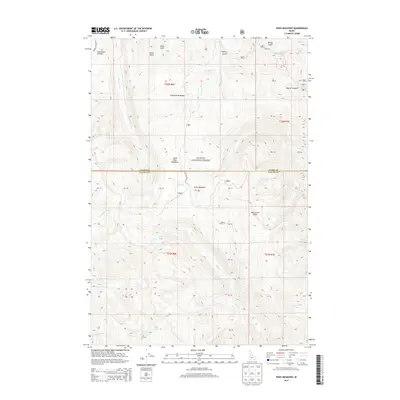
2013 Map of Pony Meadows
USGS Topo · Published 2013About this map
The high alpine terrain of Payette National Forest dominates this 2013 survey of the Central Idaho backcountry. Located along the border of Idaho and Valley Counties, the landscape is defined by its dramatic relief, reaching peaks like Steamboat Summit and Warren Summit. The area's hydrology is marked by high-elevation water bodies such as Blue Lake, Bear Lake, and Steamboat Lake, which feed a complex network of drainages including Steamboat Creek and Warren Creek. The historical Warren Wagon Rd provides a primary point of access through this timbered wilderness, tracing a route used since the region's early mining days. Between these summits lie significant high-mountain clearings like Keystone Meadows, Pony Meadows, and Little Pony Meadows, which have long served as landmarks for travelers and foresters navigating the high country.
Find a feature on this map
36 named features on this map. Tap any name to fly to it.
Don’t see what you’re looking for? This feature index may not catch every label — zoom into the map to look around manually.
Map Details
Editions of this 2013 Pony Meadows Map
This is the sole edition of this map. No revisions or reprints were ever made.
Other maps of this area

1956 · Burgdorf
USGS Topo · 1:62,500

1956 · Warren
USGS Topo · 1:62,500

1956 · Elk City
USGS Topo · 1:250,000

1960 · Elk City
USGS Topo · 1:250,000

1969 · Loon Lake
USGS Topo · 1:24,000

1969 · Pony Meadows
USGS Topo · 1:24,000

1969 · Enos Lake
USGS Topo · 1:24,000

1969 · Parks Peak
USGS Topo · 1:24,000

1969 · Williams Peak
USGS Topo · 1:24,000

1969 · Pilot Peak
USGS Topo · 1:24,000