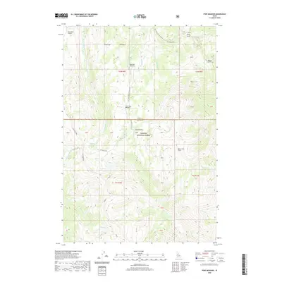
2020 Map of Pony Meadows
USGS Topo · Published 2020About this map
Keystone Meadows and Little Pony Meadows anchor a landscape defined by high-elevation drainage networks and steep ridgelines at the boundary of Idaho and Valley Counties. This 2020 Payette National Forest territory is dominated by the massive Steamboat Ridge, which forms a central spine between Steamboat Cr and Grimmet Creek. The presence of several high lakes, including Steamboat Lake, Bear Lake, and Blue Lake, suggests a high-basin environment where water collects before descending into narrow gulches. Historical nomenclature like Whangdoodle Cr and Arlise Gulch points to the area's prospecting or local naming traditions. Accessibility is largely limited to forest corridors like Natl Forest Develop Road 359 Rd, which crosses between the two counties near the namesake Pony Meadows.
Find a feature on this map
47 named features on this map. Tap any name to fly to it.
Don’t see what you’re looking for? This feature index may not catch every label — zoom into the map to look around manually.
Map Details
Editions of this 2020 Pony Meadows Map
This is the sole edition of this map. No revisions or reprints were ever made.
Other maps of this area

1956 · Burgdorf
USGS Topo · 1:62,500

1956 · Warren
USGS Topo · 1:62,500

1956 · Elk City
USGS Topo · 1:250,000

1960 · Elk City
USGS Topo · 1:250,000

1969 · Loon Lake
USGS Topo · 1:24,000

1969 · Pony Meadows
USGS Topo · 1:24,000

1969 · Enos Lake
USGS Topo · 1:24,000

1969 · Parks Peak
USGS Topo · 1:24,000

1969 · Williams Peak
USGS Topo · 1:24,000

1969 · Pilot Peak
USGS Topo · 1:24,000