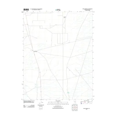
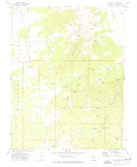
2012 Map of Pony Springs
USGS Topo · Published 2012About this map
Pony Springs serves as a small waypoint in this high-desert region of Lincoln County, where water sources dictate the landscape's utility. The presence of numerous named water features, including Pony Spring, Rosebud Spring, Cedar Spring, and Willow Tree Spring, highlights the critical importance of localized hydrology for livestock and early travelers. The terrain is structured by a grid of rural access routes like Lake Valley Acres Rd and D Ranch Rd, reflecting late-20th-century land divisions and ranching infrastructure. Aviation history is noted by the Lake Valley Landing Strip in the northern portion of the quadrangle, while the Divide Reservoir provides a man-made water catchment to the south. This survey documents the intersection of modern road networks with the reliable desert springs that have historically sustained this corner of Nevada.
Find a feature on this map
12 named features on this map. Tap any name to fly to it.
Don’t see what you’re looking for? This feature index may not catch every label — zoom into the map to look around manually.
Map Details
Editions of this 2012 Pony Springs Map
This is the sole edition of this map. No revisions or reprints were ever made.
Other maps of this area

1915 · Bristol Range
USGS Topo · 1:62,500

1917 · Bristol Range
USGS Topo · 1:62,500

1956 · Lund
USGS Topo · 1:250,000

1960 · Lund
USGS Topo · 1:250,000
1970 · Mt. Wilson
USGS Topo · 1:24,000
1971 · Bristol Range NE
USGS Topo · 1:24,000
1971 · Fairview Peak
USGS Topo · 1:24,000

1973 · Schoolmarm Basin
USGS Topo · 1:24,000

1973 · Horse Corral Pass
USGS Topo · 1:24,000
1973 · Grassy Mtn
USGS Topo · 1:24,000