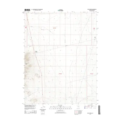
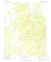
2014 Map of Pony Springs
USGS Topo · Published 2014About this map
Pony Springs serves as a central landmark in this high-desert landscape of Lincoln County, where the eastern slopes of the Fairview Range meet the wide expanse of Lake Valley. This 2014 survey reveals a territory defined by its water sources, essential for ranching and survival in the Great Basin. A series of named seeps and springs, including Rosebud Spring, Cedar Spring, and Wardell Spring, dot the base of the mountains, indicating the vital hydrological network that supported local homesteading. The infrastructure is characterized by remote desert roads like Lake Valley Rd and Atlanta Rd, while the Divide Reservoir suggests modern water management efforts. The map captures the intersection of natural topography and land-use boundaries, such as t6n r66e, documenting how these remote Nevada ranges were organized and utilized into the early 21st century.
Find a feature on this map
22 named features on this map. Tap any name to fly to it.
Don’t see what you’re looking for? This feature index may not catch every label — zoom into the map to look around manually.
Map Details
Editions of this 2014 Pony Springs Map
This is the sole edition of this map. No revisions or reprints were ever made.
Other maps of this area

1915 · Bristol Range
USGS Topo · 1:62,500

1917 · Bristol Range
USGS Topo · 1:62,500

1956 · Lund
USGS Topo · 1:250,000

1960 · Lund
USGS Topo · 1:250,000
1970 · Mt. Wilson
USGS Topo · 1:24,000
1971 · Bristol Range NE
USGS Topo · 1:24,000
1971 · Fairview Peak
USGS Topo · 1:24,000

1973 · Schoolmarm Basin
USGS Topo · 1:24,000

1973 · Horse Corral Pass
USGS Topo · 1:24,000
1973 · Grassy Mtn
USGS Topo · 1:24,000