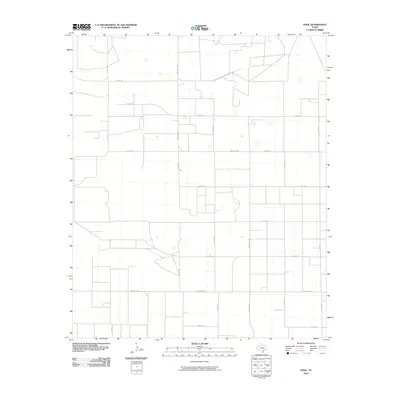
2010 Map of Pool
USGS Topo · Published 2010About this map
Terry County, Texas, is defined by an extensive grid of agricultural and transport arteries in this high-plains landscape. The geometric precision of the South Plains is on full display, where vital connectors such as Farm Rd 211 and Ranch Rd 2196 facilitate the movement of local resources across the county. The map detail highlights the intersection of rural ranching and farming life, centered on a network of county roads including Co Rd 195 and Co Rd 305. The uniform spacing of these routes suggests a landscape dedicated to large-scale agriculture, with scattered residences and property improvements visible along the thoroughfares. This documentation by the U. S. Geological Survey provides a precise account of the modern rural infrastructure, showing the relationship between local access roads like Co Rd 220 and the larger regional arteries like Ranch Rd 303.
Find a feature on this map
17 named features on this map. Tap any name to fly to it.
Don’t see what you’re looking for? This feature index may not catch every label — zoom into the map to look around manually.
Map Details
Editions of this 2010 Pool Map
This is the sole edition of this map. No revisions or reprints were ever made.
Other maps of this area

1954 · Brownfield
USGS Topo · 1:250,000

1958 · Brownfield
USGS Topo · 1:250,000

1962 · Brownfield
USGS Topo · 1:250,000

1965 · Sundown
USGS Topo · 1:24,000

1965 · Plains 1 NE
USGS Topo · 1:24,000

1965 · Lockettville
USGS Topo · 1:24,000

1969 · Gomez
USGS Topo · 1:24,000

1969 · Plains 1 SE
USGS Topo · 1:24,000

1969 · Sundown SE
USGS Topo · 1:24,000

1969 · Pool
USGS Topo · 1:24,000