
1969 Map of Sundown SE
USGS Topo · Published 1971About this map
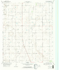
Needmore serves as a central hub for the agricultural and industrial activity of this West Texas landscape during the late 1960s. The presence of a Cotton Gin and a County Auxiliary Airfield reflects a community organized around the demands of high-plains farming and aviation infrastructure. The terrain is defined by the subtle depressions of Lost Draw and Sulphur Draw, which cut through the otherwise level topography of Terry County.
Find a feature on this map
12 named features on this map. Tap any name to fly to it.
Don’t see what you’re looking for? This feature index may not catch every label — zoom into the map to look around manually.
Map Details
Editions of this 1969 Sundown SE Map
2 editions found
Other maps of this area

1954 · Brownfield
USGS Topo · 1:250,000

1957 · Meadow
USGS Topo · 1:62,500

1958 · Brownfield
USGS Topo · 1:250,000

1962 · Brownfield
USGS Topo · 1:250,000

1965 · Sundown
USGS Topo · 1:24,000

1965 · Lockettville
USGS Topo · 1:24,000

1969 · Brownfield East
USGS Topo · 1:24,000

1969 · Gomez
USGS Topo · 1:24,000

1969 · Pool
USGS Topo · 1:24,000
1969 · Brownfield West
USGS Topo · 1:24,000