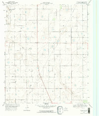
1969 Map of Sundown SE
USGS Topo · Published 1971About this map
The High Plains of Terry County are defined here by a series of shallow depressions and ephemeral watercourses. In the late 1960s, this landscape supported a sparse settlement pattern centered around small hubs like Needmore and Wooldridge. The economy is clearly tied to the land, evidenced by a Cotton Gin and a Gravel Pit positioned near the basin of Lost Draw. Modern infrastructure, including a prominent Pipeline and multiple Substations, cuts across the grid-based road network, reflecting the region's energy development during this era.
Find a feature on this map
12 named features on this map. Tap any name to fly to it.
Don’t see what you’re looking for? This feature index may not catch every label — zoom into the map to look around manually.
Map Details
Editions of this 1969 Sundown SE Map
2 editions found
Other maps of this area

1954 · Brownfield
USGS Topo · 1:250,000

1957 · Meadow
USGS Topo · 1:62,500

1958 · Brownfield
USGS Topo · 1:250,000

1962 · Brownfield
USGS Topo · 1:250,000

1965 · Sundown
USGS Topo · 1:24,000

1965 · Lockettville
USGS Topo · 1:24,000

1969 · Brownfield East
USGS Topo · 1:24,000

1969 · Gomez
USGS Topo · 1:24,000

1969 · Sundown SE
USGS Topo · 1:24,000

1969 · Pool
USGS Topo · 1:24,000