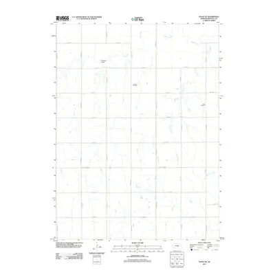
2011 Map of Poole NE
USGS Topo · Published 2011About this map
Antelope Valley defines the landscape of this Buffalo County survey, which documents the rural grid and watercourses of central Nebraska. The terrain is structured by a network of sectional roads, including Grand Island Rd and Husker Rd, reflecting the enduring agricultural organization of the Great Plains. The drainage patterns of Sweet Creek and Cherry Creek meander across the township lines, providing the primary natural breaks in the geometric road layout. For local historians and genealogists, the map identifies two significant sites of early settlement: Sodtown Cemetery and Moss Cemetery. These landmarks, along with family-named roads like Gibbon Rd and Pawnee Rd, preserve the footprint of the farming families who established this community. The map serves as a detailed record of the section-line infrastructure and natural hydrology that have shaped the region's development into the twenty-first century.
Find a feature on this map
21 named features on this map. Tap any name to fly to it.
Don’t see what you’re looking for? This feature index may not catch every label — zoom into the map to look around manually.
Map Details
Editions of this 2011 Poole NE Map
This is the sole edition of this map. No revisions or reprints were ever made.
Other maps of this area

1895 · Wood River
USGS Topo · 1:62,500

1896 · Wood River
USGS Topo · 1:125,000

1899 · Loup
USGS Topo · 1:125,000

1953 · Rockville
USGS Topo · 1:24,000

1953 · Boelus
USGS Topo · 1:24,000

1953 · Ravenna
USGS Topo · 1:24,000

1955 · Broken Bow
USGS Topo · 1:250,000

1955 · Grand Island
USGS Topo · 1:250,000

1956 · Broken Bow
USGS Topo · 1:250,000

1957 · Grand Island
USGS Topo · 1:250,000