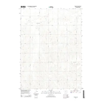
2014 Map of Poole NE
USGS Topo · Published 2014About this map
Antelope Valley anchors this corner of Buffalo County, where the transition from undulating loess hills to structured agricultural townships is clearly defined. The landscape is primarily shaped by the drainage patterns of Sweet Cr and Cherry Cr, which carve through the terrain and influence the placement of the local section-line roads. For genealogists and local historians, the presence of Sodtown Cem and Moss Cem provides vital touchstones for tracing the families who settled this region of Nebraska. The road network, including notable thoroughfares like Grand Island Rd and Sodtown Rd, follows the classic grid system, reflecting the 19th-century land surveys that still dictate the rural geography of the Great Plains in the modern era.
Find a feature on this map
21 named features on this map. Tap any name to fly to it.
Don’t see what you’re looking for? This feature index may not catch every label — zoom into the map to look around manually.
Map Details
Editions of this 2014 Poole NE Map
This is the sole edition of this map. No revisions or reprints were ever made.
Other maps of this area

1895 · Wood River
USGS Topo · 1:62,500

1896 · Wood River
USGS Topo · 1:125,000

1899 · Loup
USGS Topo · 1:125,000

1953 · Rockville
USGS Topo · 1:24,000

1953 · Boelus
USGS Topo · 1:24,000

1953 · Ravenna
USGS Topo · 1:24,000

1955 · Broken Bow
USGS Topo · 1:250,000

1955 · Grand Island
USGS Topo · 1:250,000

1956 · Broken Bow
USGS Topo · 1:250,000

1957 · Grand Island
USGS Topo · 1:250,000