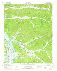
1949 Map of Pope
USGS Topo · Published 1975About this map
The Tennessee River corridor defines the western edge of this landscape, where the waters of Kentucky Lake meet the shores of Perry and Decatur counties. At the time of this survey, the river economy is reflected in a series of landings like Brownsport Landing, Kellys Landing, and Vise Landing, while a Gaging and pumping station stands near the mouth of Cedar Creek. The interior is heavily carved by named hollows such as Henson Hollow and Duncan Hollow, leading to high points like Horses Head. Evidence of early industrial history appears along Furnace Branch, where an Ore furnace stack (Abandoned) remains. Local genealogy is well-preserved through numerous family burying grounds, including the Gobelet Cem, Broadway Cem, and Horner Cem, alongside community hubs like Smith Bottom Church.
Find a feature on this map
102 named features on this map. Tap any name to fly to it.
Don’t see what you’re looking for? This feature index may not catch every label — zoom into the map to look around manually.
Map Details
Editions of this 1949 Pope Map
2 editions found
Other maps of this area

1905 · Waynesboro
USGS Topo · 1:125,000

1936 · Pine View
USGS Topo · 1:24,000

1936 · Bath Springs
USGS Topo · 1:24,000

1936 · Linden
USGS Topo · 1:24,000

1936 · Leatherwood
USGS Topo · 1:24,000

1936 · Clifton
USGS Topo · 1:24,000

1936 · Chestnut Grove
USGS Topo · 1:24,000

1936 · Jeannette
USGS Topo · 1:24,000

1936 · Perryville
USGS Topo · 1:24,000

1936 · Pope
USGS Topo · 1:24,000