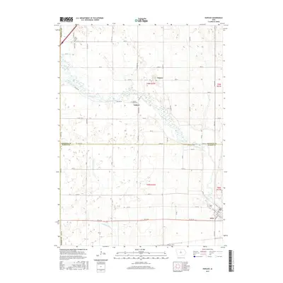
2015 Map of Popejoy
USGS Topo · Published 2015About this map
The Iowa River meanders across this prairie landscape of Franklin and Hardin Counties, defining the agricultural character of north-central Iowa. Near the southeastern corner, the settlement of Alden sits along the river's edge, served by the nearby Alden Cem. To the north, the small community of Popejoy stands within a grid of section-line roads, including Co HWY s13 and 50th ST, which facilitate the region's farm-to-market connectivity. The S Fork Iowa River flows through the southern portion of the map, joining the main branch near the historic site of Oakland. Genealogists may find interest in the scattered burial grounds, such as Otis Grove Cem and the Oakland Valley Cem, which serve as quiet markers of the area's pioneer heritage and the families who established these rural townships.
Find a feature on this map
59 named features on this map. Tap any name to fly to it.
Don’t see what you’re looking for? This feature index may not catch every label — zoom into the map to look around manually.
Map Details
Editions of this 2015 Popejoy Map
This is the sole edition of this map. No revisions or reprints were ever made.
Other maps of this area

1954 · Waterloo
USGS Topo · 1:250,000

1955 · Waterloo
USGS Topo · 1:250,000

1978 · Sheldon Creek
USGS Topo · 1:24,000

1978 · Dows West
USGS Topo · 1:24,000

1978 · Williams
USGS Topo · 1:24,000

1979 · Dows East
USGS Topo · 1:24,000

1979 · Coulter
USGS Topo · 1:24,000

1979 · Iowa Falls West
USGS Topo · 1:24,000

1979 · Buckeye West
USGS Topo · 1:24,000

1979 · Buckeye East
USGS Topo · 1:24,000