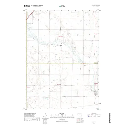
2018 Map of Popejoy
USGS Topo · Published 2018About this map
The Iowa River and the S Fork Iowa River define the agricultural landscape of north-central Iowa, where small settlements like Popejoy and Oakland emerged along the river corridors. This survey provides a clear view of the rural township structure at the county line between Franklin Co and Hardin Co. The terrain is marked by traditional section lines and a grid of rural roads such as Hardin Rd and Co Hwy S13, reflecting the enduring surveyor's grid that organized the region's farming economy.
Find a feature on this map
43 named features on this map. Tap any name to fly to it.
Don’t see what you’re looking for? This feature index may not catch every label — zoom into the map to look around manually.
Map Details
Editions of this 2018 Popejoy Map
This is the sole edition of this map. No revisions or reprints were ever made.
Other maps of this area

1954 · Waterloo
USGS Topo · 1:250,000

1955 · Waterloo
USGS Topo · 1:250,000

1978 · Sheldon Creek
USGS Topo · 1:24,000

1978 · Dows West
USGS Topo · 1:24,000

1978 · Williams
USGS Topo · 1:24,000

1979 · Dows East
USGS Topo · 1:24,000

1979 · Coulter
USGS Topo · 1:24,000

1979 · Iowa Falls West
USGS Topo · 1:24,000

1979 · Buckeye West
USGS Topo · 1:24,000

1979 · Buckeye East
USGS Topo · 1:24,000