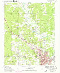
1966 Map of Poplar Bluff
USGS Topo · Published 1979About this map
The Black River meanders through the heart of this Butler County landscape, marking the transition from the heavily wooded Mark Twain National Forest in the north to the industrial and residential core of Poplar Bluff. By the mid-1960s, the city's expansion was well underway, with newer developments like Loma Linda and North Side emerging near the Poplar Bluff Country Club. The urban center is densely packed with institutional landmarks, including the V A Hospital, a sprawling City Cemetery, and the Sacred Heart Ch.
Find a feature on this map
92 named features on this map. Tap any name to fly to it.
Don’t see what you’re looking for? This feature index may not catch every label — zoom into the map to look around manually.
Map Details
Editions of this 1966 Poplar Bluff Map
3 editions found
Other maps of this area

1934 · Williamsville
USGS Topo · 1:48,000

1935 · Poplar Bluff
USGS Topo · 1:62,500

1935 · Acorn
USGS Topo · 1:62,500

1935 · Harviell
USGS Topo · 1:62,500

1939 · Poplar Bluff
USGS Topo · 1:62,500

1940 · Williamsville
USGS Topo · 1:62,500

1940 · Naylor
USGS Topo · 1:62,500

1944 · Naylor
USGS Topo · 1:62,500

1949 · Poplar Bluff
USGS Topo · 1:62,500

1957 · Poplar Bluff
USGS Topo · 1:250,000